This was a photo flight in order of a customer with a restaurant on Lake Brienz. Unfortunately he didn't want the pictures afterwards anymore. At least we had a nice flight. Today with the photo drones, it as become much easier. The camera used was a Nikon D200 with Nikkor AF-S VR 24-120mm lens.
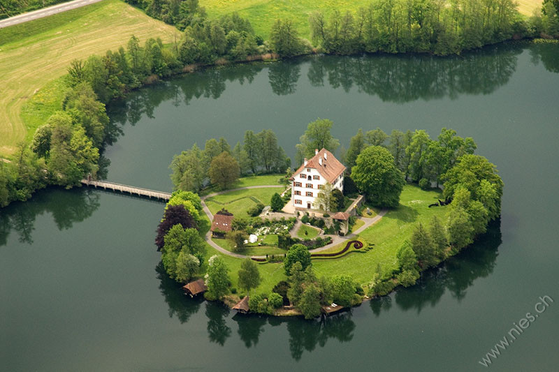
Fig. 1: The house on the small island on Lake Mauen in the municipality of Mauensee. — EXIF: Nikon D200; Δt=1/200 s; f=120 mm; f/7.1; ISO 400; 2008-05-14 13:03:03
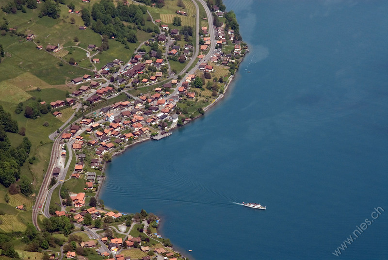
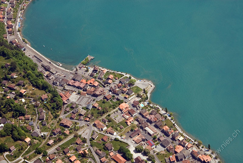
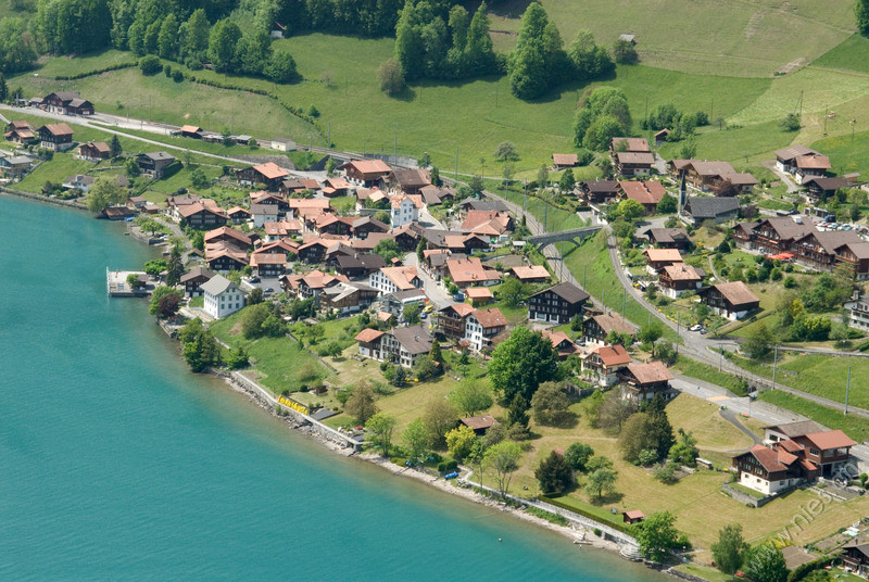
Fig. 2: Aerial view of the village Oberried on the northern shore of Lake Brienz. — EXIF: Nikon D200; Δt=1/320 s; f=102 mm; f/9.0; ISO 400; 2008-05-14 13:18:42
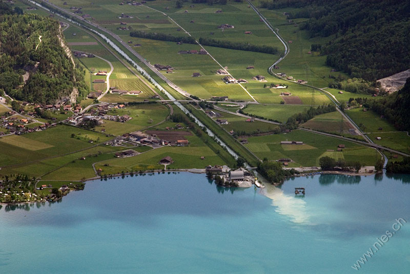
Fig. 3: The mouth of the Aare channel in Lake Brienz. One can clearly see that the river is transporting a lot of sediments. Lake Brienz acts like a cleansing basin for Lake Thun, whose water is much more clean and better suited for diving. — EXIF: Nikon D200; Δt=1/320 s; f=100 mm; f/9.0; ISO 400; 2008-05-14 13:20:01
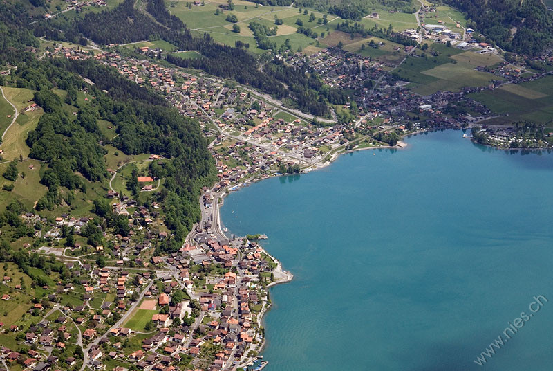
Fig. 4: In the foreground lies the village Brienz and behind it is Schwanden. — EXIF: Nikon D200; Δt=1/320 s; f=55 mm; f/9.0; ISO 400; 2008-05-14 13:20:08
Fig. 5: Aerial view of Brienz with the lakeside premenade, the jetty and the station of the beautyful cog railway Brienz-Rothorn-Bahn. — EXIF: Nikon D200; Δt=1/320 s; f=52 mm; f/9.0; ISO 400; 2008-05-14 13:20:28
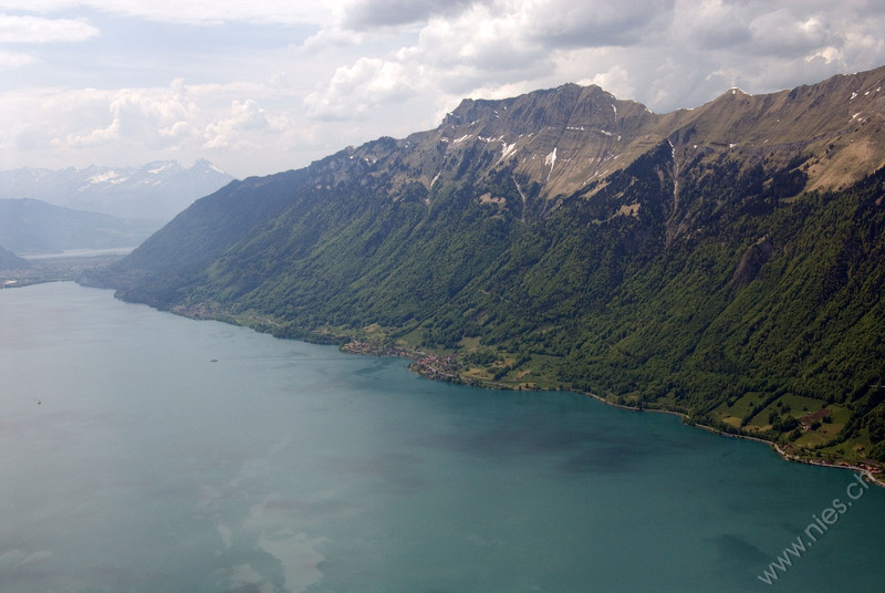
Fig. 6: The mountain chain from Brienzer Rothorn (2340m) to Harder. In the middle of the image is the village Oberried on the northern shore of Lake Brienz. — EXIF: Nikon D200; Δt=1/250 s; f=34 mm; f/9.0; ISO 400; 2008-05-14 13:20:55
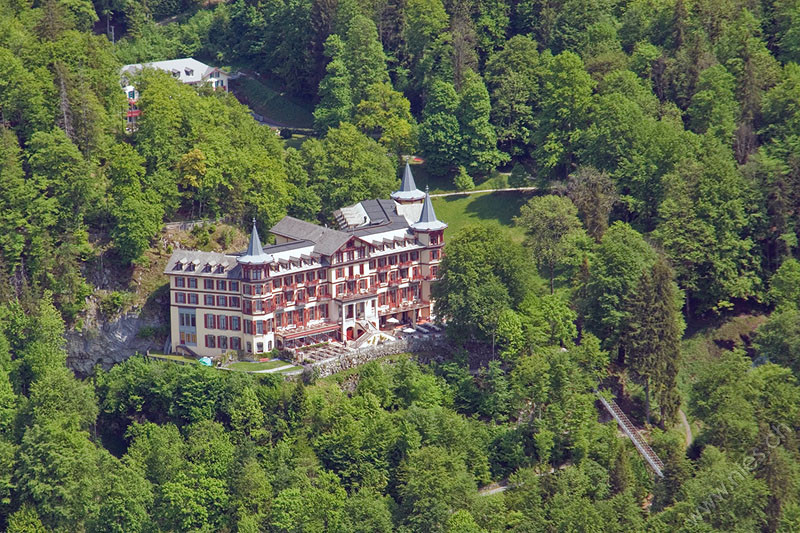
Fig. 7: The Hotel-Restaurant Bären in the center of the immage lies in the west of the small village Oberried. A few year later, in the night from 12 to 13 February 2011 it burned down. — EXIF: Nikon D200; Δt=1/250 s; f=110 mm; f/8.0; ISO 400; 2008-05-14 13:22:28
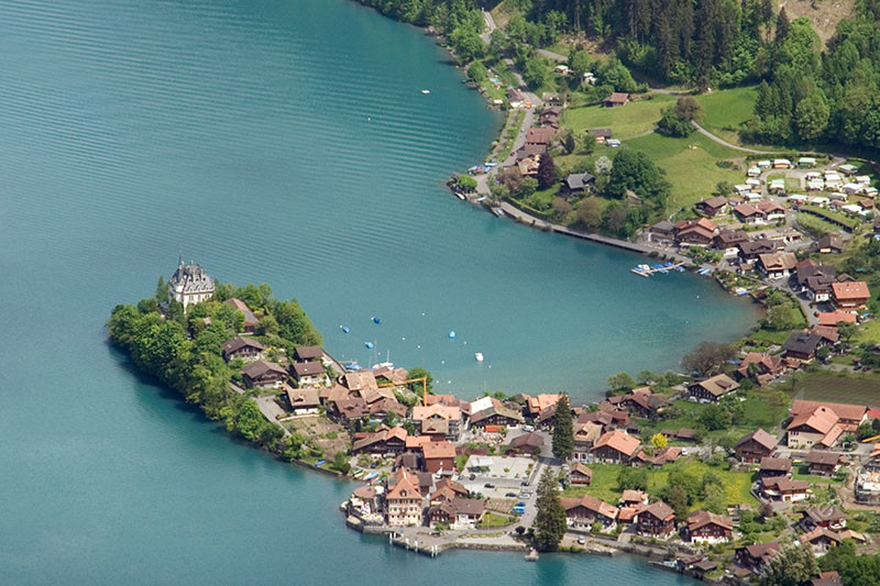
Fig. 8: The small fishing village Iseltwald with the idyllic bay and the prominent castle on the southern shore of Lake Brienz. — EXIF: Nikon D200; Δt=1/400 s; f=120 mm; f/11.0; ISO 400; 2008-05-14 13:24:05
Fig. 9: Aerial view of Grandhotel Giessbach on the southern shore of Lake Brienz. One can see the tracks of the historial funicular railway. Nearby are the Giessback Falls. — EXIF: Nikon D200; Δt=1/250 s; f=120 mm; f/10.0; ISO 400; 2008-05-14 13:26:08
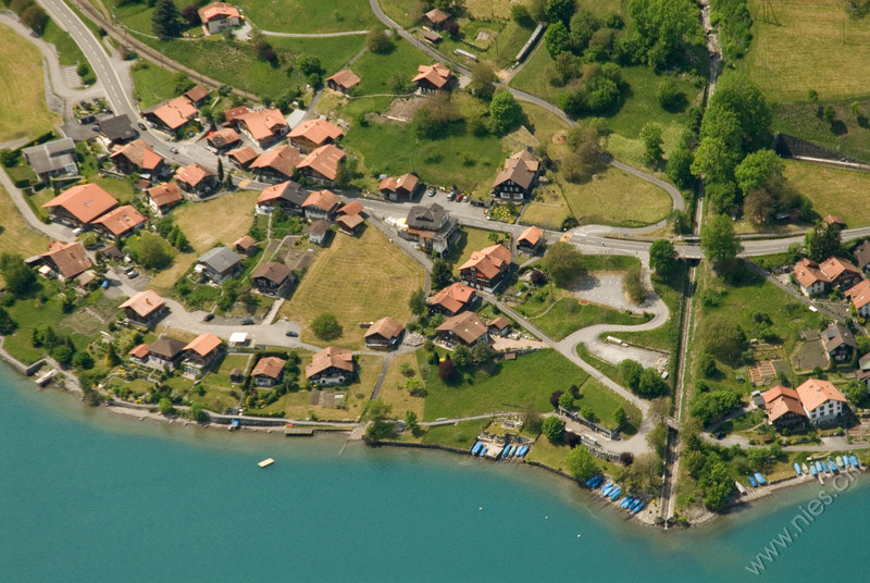
Fig. 10: Aerial view of village Oberried on the northern shore of Lake Brienz. — EXIF: Nikon D200; Δt=1/320 s; f=65 mm; f/11.0; ISO 400; 2008-05-14 13:28:04
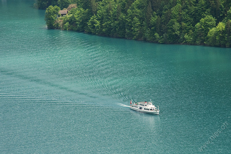
Fig. 11: A passenger ship on Lake Brienz. — EXIF: Nikon D200; Δt=1/1000 s; f=120 mm; f/5.6; ISO 400; 2008-05-14 13:33:54
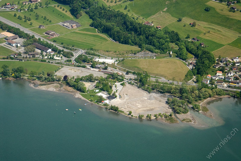
Fig. 12: The lake bath and camping ground at Lake Sarnen was destroyed during a thunderstorm and flood in 2005. — EXIF: Nikon D200; Δt=1/400 s; f=62 mm; f/5.6; ISO 400; 2008-05-14 13:42:03
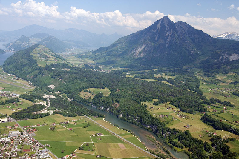
Fig. 13: Aerial view on the narrow Lake Wichel with the river Sarner Aa, which flows into Lake Alpnach (a part of Lake Lucerne). The prominent mountain is Mount Stanserhorn. The village in the lower left corner is Kägiswil. — EXIF: Nikon D200; Δt=1/500 s; f=24 mm; f/5.6; ISO 400; 2008-05-14 13:43:04
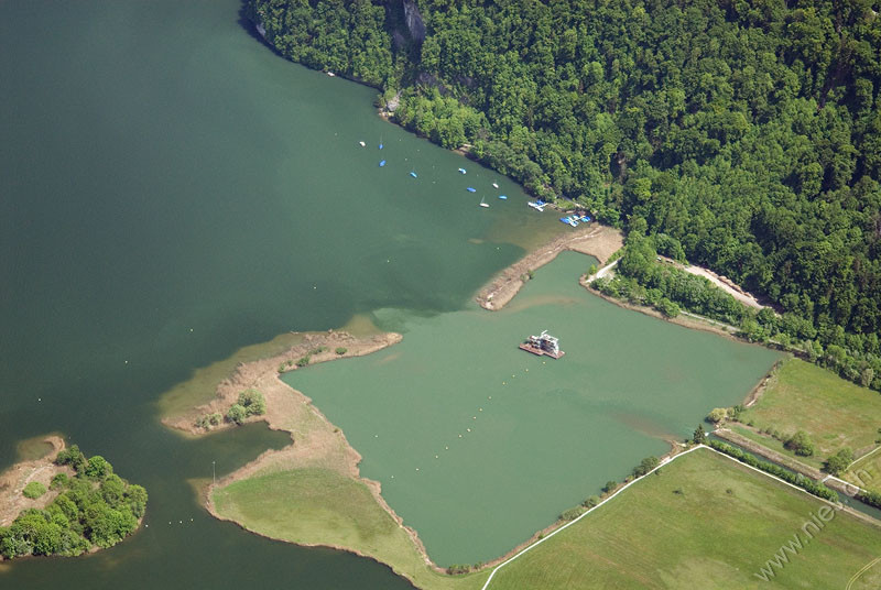
Fig. 14: The mouth of the river Sarner Aa into Lake Alpnach, which is a part of Lake Lucerne. What's that for a raft? Maybe for digging sand or gravel. — EXIF: Nikon D200; Δt=1/320 s; f=62 mm; f/5.6; ISO 400; 2008-05-14 13:44:20
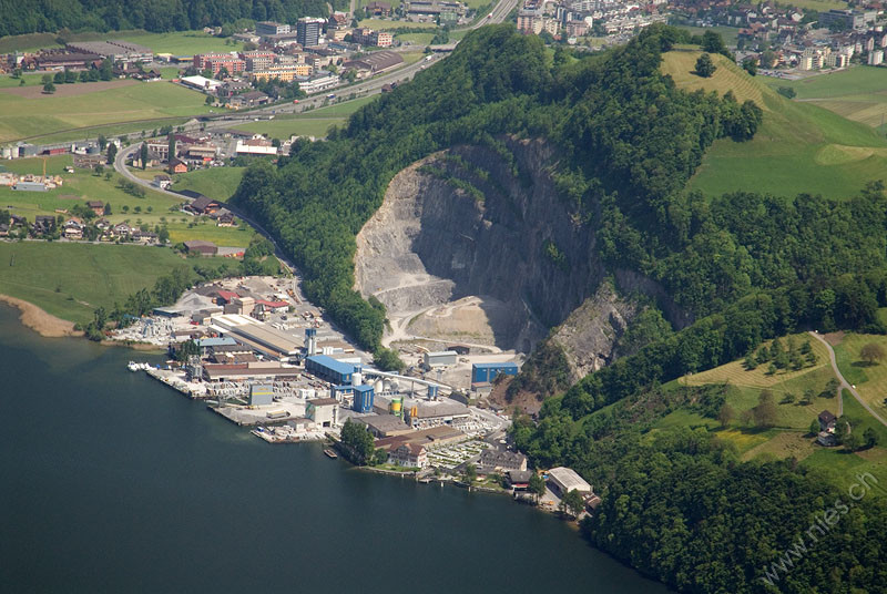
Fig. 15: The concrete factory Rotzloch Müller-Steinag Gruppe. Rotzloch means "snotting hole" in english. Maybe the people there always catch a cold. — EXIF: Nikon D200; Δt=1/350 s; f=120 mm; f/5.6; ISO 400; 2008-05-14 13:44:44
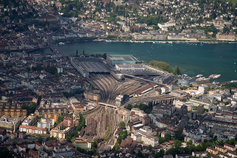
Fig. 16: Aerial view of Lucerne with the train station and the Culture and Congress Center (KKL). — EXIF: Nikon D200; Δt=1/640 s; f=95 mm; f/5.6; ISO 400; 2008-05-14 13:46:33
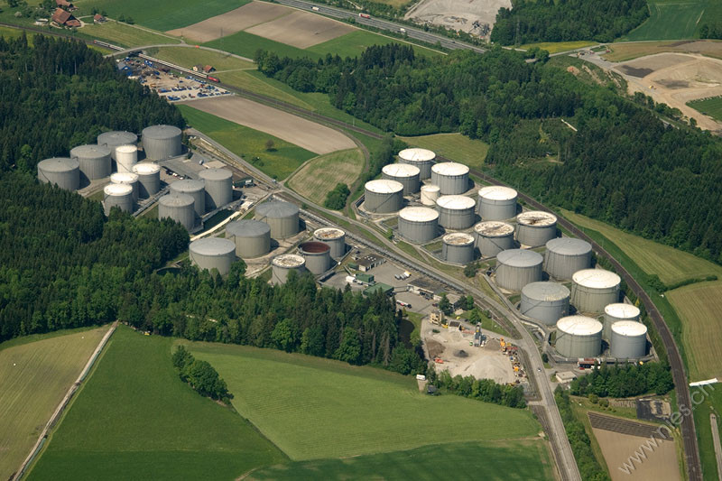
Fig. 17: Aerial view of the storage tanks at Rothenburg where 200 million liters fuel are stored. — EXIF: Nikon D200; Δt=1/640 s; f=65 mm; f/5.6; ISO 400; 2008-05-14 13:48:47